The United Kingdom is currently facing one of its most significant meteorological challenges of the season as a “multi-hazard” weather system, named Storm Goretti, sweeps across the British Isles. The Met Office has escalated its response, issuing a series of amber and yellow weather warnings for snow, ice, and wind that are set to disrupt transport, energy networks, and daily life through to the weekend. With accumulations of up to 30cm possible in some regions and wind gusts threatening to reach 90mph in exposed coastal areas, the nation is being urged to prioritise safety and resilience.
This cold snap arrives as part of a broader atmospheric shift, where a deep area of low pressure from the Atlantic is colliding with a stubborn block of Arctic air sitting over the UK. The result is a volatile mix of heavy snowfall on the northern edge of the storm and torrential rain and gales to the south. From the Highlands of Scotland to the Cornish coast, the impacts are being felt by millions, highlighting the critical importance of robust infrastructure and community vigilance during periods of environmental stress.
Storm Goretti: A Detailed Forecast of Wintry Disruption
The current weather event is characterized by its complexity and geographical reach. Meteorologists have identified approximately 95 regions at risk of significant snowfall. The primary concern for central and northern parts of England, as well as much of Wales, is the rapid accumulation of snow as the storm moves north-eastwards.
Regional Breakdown of Warnings
- The Midlands and Wales: An amber warning is in effect, with the potential for 15-25cm of snow to settle quite widely. In higher elevations, such as the Peak District and the Welsh mountains, totals could exceed 30cm.
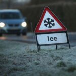
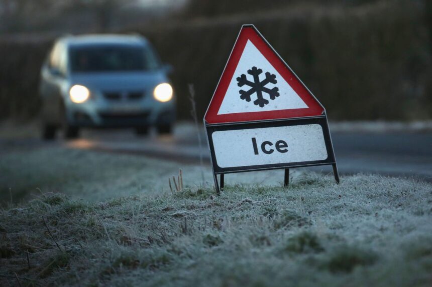
- Northern England and Scotland: Persistent ice warnings remain active as temperatures dip well below freezing. Freezing rain—a rare but dangerous phenomenon—has been reported in parts of Northern Ireland and northern Cumbria, creating “black ice” conditions on untreated surfaces.
- South West England: While snow is less likely here, the “multi-hazard” nature of Storm Goretti is evident in the amber wind warnings. Gusts of 80-90mph are expected across Cornwall and the Isles of Scilly, posing a risk to life from flying debris and large waves.
The UK Health Security Agency (UKHSA) has extended an amber cold health alert until Sunday, 11 January. This indicates that the weather is likely to have a “significant impact” on the health and social care sector, particularly for those in vulnerable demographics.
The Health Implications of Prolonged Cold Exposure
Extreme winter weather is more than an inconvenience; it is a serious public health challenge. According to the World Health Organization (WHO), cold-related illnesses account for a substantial burden on global health systems. In the UK, winter mortality is significantly higher than in other seasons, with thousands of excess deaths often attributed to periods of extreme cold and poorly insulated housing.
The physiological response to dropping temperatures is immediate. Exposure to cold can lead to a rise in blood pressure and increased blood viscosity, which in turn raises the risk of cardiovascular events such as heart attacks and strokes. Furthermore, the OECD has noted that the resilience of a nation’s health system is frequently tested by such seasonal shocks, requiring proactive strategies to protect the elderly and those with pre-existing respiratory conditions.
Expert Note: “GP visits for respiratory illnesses can increase by nearly 20% for every degree the temperature drops below 5°C,” according to data from public health monitoring bodies. This highlights the necessity of maintaining indoor temperatures at a minimum of 18°C where possible.
Infrastructure and Economic Resilience
The economic cost of severe snow and ice is felt across multiple sectors. From grounded flights at major hubs to the closure of the rail network, the UK’s transport infrastructure faces a rigorous test. National Highways has issued its own amber alerts, warning drivers that travel should only be undertaken if absolutely essential.
The World Bank emphasizes that infrastructure resilience is a cornerstone of modern economic stability. In the UK, where the quality of infrastructure is often cited as a key area for development, the ability of the National Grid to withstand Storm Goretti’s winds while meeting the surge in heating demand is paramount. Power outages remain a significant risk in rural communities, where heavy snow can bring down overhead lines and make access for repair crews nearly impossible.
Key Safety Steps for Households
- Check on Neighbours: Ensure that elderly or isolated residents have sufficient food and heat.
- Vehicle Preparedness: If you must travel, carry a winter kit including blankets, a shovel, a torch, and a fully charged mobile phone.
- Home Maintenance: Clear paths of snow and ice early in the day when it is easier to move, and use salt or sand to prevent refreezing.
The Long-Term View: Climate Variability and Winter Extremes
While the immediate focus remains on Storm Goretti, climatologists are increasingly looking at how such events fit into a changing global climate. Although average winter temperatures are rising, the frequency of “extreme variability” is also increasing. This means that while we may see fewer cold days overall, the cold snaps we do experience can be more intense and disruptive.
The World Economic Forum (WEF) identifies “natural disasters and extreme weather events” as one of the top global risks in its annual reports. For the UK, this translates to a need for long-term strategic planning—from upgrading the thermal efficiency of the housing stock to investing in flood defences that can handle the rapid snowmelt that often follows a major blizzard.
Conclusion
The current severe snow and ice warnings serve as a stark reminder of nature’s power to halt even the most advanced societies. As Storm Goretti continues its path across the UK, the combined efforts of the Met Office, emergency services, and local communities are vital in mitigating the risks. By staying informed through official weather alerts and adhering to safety guidance, the public can navigate this wintry period with minimal harm.
The resilience shown in the face of these conditions will define the coming days. As we look toward the weekend, the forecast suggests a slow return to milder air, but the lessons learned during this week of extreme weather will undoubtedly shape the nation’s future approach to winter preparedness.